
Full Report here: EOSC410_TermProject_Presentation_EvanSimon
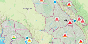
Avalanche danger ratings are key resources for backcountry users as well as ski resorts, guiding services, highway infrastructure, and resource industry professionals. Avalanches are caused by instabilities in the snowpack, which become activated by either human or natural triggers. These instabilities are influenced by meteorological variables (i.e. climatic predictor variables) such as precipitation, temperature, wind, and air pressure. Which climatic predictor(s) is/are the most important predictor(s) of avalanche risk for each elevation level in the Sea to Sky Region? Do similar important climatic predictors of avalanche risk exist between different mountain regions for the three different elevation levels (Below Treeline, Treeline, Alpine)?
We complied avalanche danger ratings for 12 mountain regions in Canada from 2012-2017, as well as ERA5 re-analysis climate data for each region during this timeframe. We then built a multiple linear regression (MLR) model for each elevation level and calculated MLR coefficients for each normalized climate predictor to see which predictors are the most important predictors of avalanche class for each elevation level. Multiple linear regression showed no significant correlation between 2-meter air temperature, 10-metre U wind component, 10-metre V wind component, mean sea level pressure, total precipitation, and the avalanche danger ratings for all the different mountain ranges. Alternative statistical analysis should be used and/or alternative climatological data should be used as the chosen climate predictors are important for predicting avalanche risk in reality. For future analysis: adjust the temporal scale of our model to look at weekly or even monthly trends as opposed to daily observations, and adjust the spatial scale of our model to encompass smaller areas within each region, this might help limit the spatial variability we see within the Climate Re-analysis data.
- Gained experience writing advanced functions and creating models using Python 3.7
- Learned how to extract large spatial climate data on the public ERA data portal
- Opportunity to investigate a research question that is important to me personally as a backcountry skier